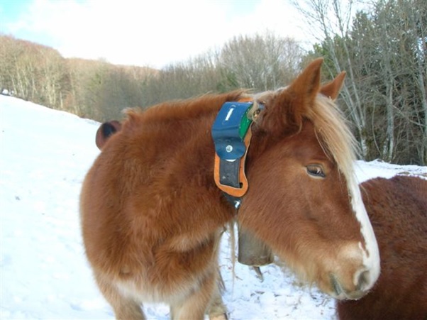
Cattle geolocation
GPS geolocation of cattle is a technology that allows knowing the location and status of animals in real time through devices that are placed on the animal’s collar or ear. This technology has several advantages for farmers, such as:
– Avoid theft, loss or attacks by predators, by being able to locate the animals at all times and receive alerts if they leave a defined area.
– Optimize livestock management and productivity by facilitating animal health, reproductive, and nutritional control.
– Reduce costs and working time, by reducing surveillance and displacement tasks
– Detect diseases, injuries or births, by being able to monitor body temperature, heart rate and movement of animals.
– Prevent thermal stress, dehydration or lack of food, by being able to measure the humidity, temperature and quality of the pasture in the environment of the animals.
GPS devices send their position and other data through a satellite signal and LORA network. These devices can have different characteristics, such as:
– Rechargeable or solar battery.
– Resistance to water and dust.
There are different brands and models of GPS devices for livestock on the market, such as dragino, browan, etc…
Geolocation in livestock farming is a technological solution that can help comply with animal welfare regulations, by allowing continuous and remote monitoring of animals and their environmental conditions. Geolocation in livestock can prevent theft, loss or attacks by predators in the following way:
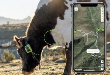
– GPS devices send the exact position of the animals to the farmer’s mobile or web application, allowing him to know where they are at all times and if they stray too far from the herd or grazing area.
– The farmer’s mobile or web application allows you to create virtual zones or geofences, which are areas delimited by geographic coordinates. If an animal leaves a virtual zone, the farmer receives an alert on his phone or email.
– Some GPS devices also have a motion sensor, which detects whether the animal is running, jumping or standing still. If the sensor detects abnormal movement or prolonged inactivity, the farmer receives an alert on his phone or email.
These alerts allow the farmer to intervene quickly in the event that an animal is in danger or has been stolen.
AtlasLocator could be used to geolocate cattle. AtlasLocator is a graph and map based IOT device management ecosystem. It mainly focuses on the geolocation of different objects, animals and people through IOT technology. AtlasLocator enables GPS devices to send their position and other data to a mobile or web application. The application allows you to create virtual zones or geofences, receive alerts and view the history of animal movements.
AtlasLocator offers geolocation solutions for different sectors, such as livestock, agriculture, logistics or security. Its objective is to facilitate the control and management of resources through the use of IOT devices and mobile or web applications.
AtlasLocator adapts to the needs of each client. For example, there are devices that have a solar-powered rechargeable battery, that have a motion sensor, or that have an SOS button. Devices can be configured to send data as often as desired and can be remotely turned on or off.
The AtlasLocator mobile or web application allows you to view the position and status of the devices in real time on an interactive map. The application also allows you to create virtual zones or geofences, receive alerts by email or TELEGRAM and view the movement history of the devices. The application is compatible with Android and iOS and can be accessed from any device with an internet connection.